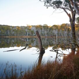
Mokoan Discovery Trail
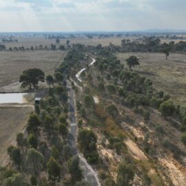
To the east of Benalla lies the Mokoan Discovery Trail. Stretching from Sydney Road to the Winton Wetlands, this gravel walking and cycle path awaits exploration, while native vegetation planted by local environmental groups enhances the region’s natural beauty and biodiversity. Embark on the 20 kilometre Mokoan Discovery Trail starting at Witt Street in Benalla…
Read MoreLima Falls Walk
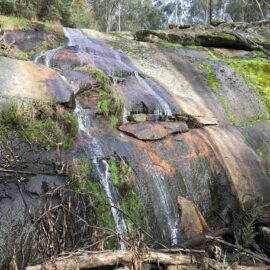
Lima Falls is a small and pretty waterfall on White Gum Gully Creek. The falls are approximately 42 kilometres south of Benalla and just off Police Track, and through pine plantations. The road is unsealed and is accessible by 2WD, however, this is weather permitting. To get to the falls follow the road signs (small…
Read MoreSwanpool Heritage Murals
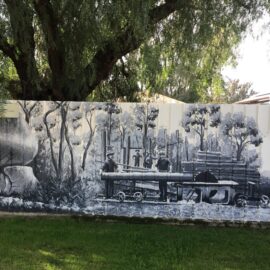
Looking to explore more art in the region? Take a scenic 20-minute drive from Benalla to Swanpool and discover the charming Swanpool Heritage Murals, located near the local store. These captivating artworks depict the early days of the Swanpool district, bringing local history to life through the talents of artists Michael Larkin and Tim Bowtell,…
Read MoreRed Ramia Trading

Red Ramia Trading is an enormous globe-trotter’s emporium from fishing floats and hand painted tiles to larger than life gorillas. There is certainly more to see than the front entrance suggests. Take a trip through Japan, Morocco and India as you wander through a mixture of hand picked antiques, artisan crafted good and recycled items.…
Read MoreEdi Cutting Reserve
This very large free bush camping area continues for approximately two kilometers alongside the King River. There are several fire pits and two pit toilets – one at each end of the camp. The area is shaded by tall gum trees and is popular with groups as there is plenty of room and drive through…
Read MoreWild Dog Falls Walk and lookout – Mount Samaria
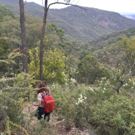
Escape into nature on the breathtaking walk to Wild Dog Falls – one of Mount Samaria State Park’s best-kept secrets. This 1.5 kilometre (40-minute return) Level 3 hike offers the perfect balance of challenge and reward for those with moderate fitness. Starting from the carpark on Mount Samaria Road, the well-marked trail winds through peaceful…
Read MoreMt Stirling Alpine Resort
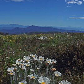
Mt Stirling Alpine Resort is the only Victorian alpine resort with a largely undeveloped and unspoilt true alpine summit, offering a readily accessible semi-wilderness experience for visitors. This fact, combined with the resort’s wealth and diversity of environmental characteristics and its close proximity to Melbourne, only 230 kilometres, makes Mt Stirling unique in the Australian…
Read MoreMt Buller Bike Park
Mt Buller offers the ideal biking escape, no matter what you are into. Tackle the 16 kilometre uphill road climb, ride the extensive cross-country trail network, hit the downhill trails or tackle the pump track – all just three hours from Melbourne. Over 100 kilometres of quality cross-country trails, including 40 kilometres of singletrack. The…
Read MoreMt Buller Alpine Resort
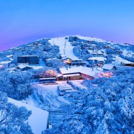
Mt Buller is Australia’s most accessible snow resort and is an easy three-hour drive from Melbourne’s Tullamarine Airport. With 21 lifts, Mt Buller has the largest lift network in Victoria. The resort features a world-class Ski and Snowboard School, three terrain parks designed for all skill levels, two toboggan parks and a beautiful alpine village…
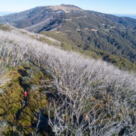
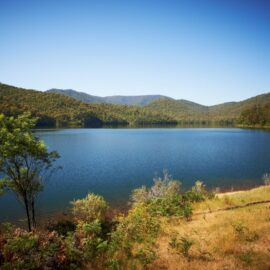
Read MoreLake Cobbler Walking Track
Lake Cobbler is a small lake created in the 1960s by damming a swamp area in the headwaters of the Dandongadale River. After leaving the lake, the river plunges over the Cobbler Plateau creating Dandongadale Falls. This is Victoria’s longest waterfall with a 255 metre drop and a popular site for Peregrine Falcon to nest.…
Read MoreBennies Camping Area – Alpine National Park
Bennies is a pretty camping area on the Rose River only 45 minutes from the Whitfield township and 45 minutes to Lake Cobbler. Follow the Rose River Road then Upper Rose River Road to Lake Cobbler Road. Camping sites are dispersed along the river with pit toilets and fireplaces provided. Explore walks along the Rose…
Read MoreWhitfield to Lake William Hovell
Enjoy cycling in the High Country from Whitfiled to Lake William Hovell. You will pass numerous vineyards, former tobacco and hops farms on your ride and could think you have been transported to Italy. Start in Whitfield and take the King Valley Road to Cheshunt. Over the bridges in Cheshunt and turn right onto Upper…
Read More